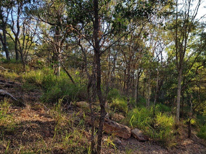
Bushfire Attack Levels (BALs) are a way of prescribing a certain standard of building design and construction, to manage potential bushfire risks (by compliance with the Australian Standard AS3959:2018 - Construction of Building in bushfire-prone areas). The BAL system is based on the potential exposure of the site to heat flux exposure thresholds, expressed at KW/m2. Proximity of the site to hazardous vegetation, surrounding slopes, location of the site and the type of vegetation are used to determine the likely bushfire risk to the site. The Queensland Fire and Rescue Service publication ‘ Bushfire Resilient Communities’ provides additional information on bushfire hazard assessments. Six BALs can be prescribed, including: Low - There is insufficient risk to warrant any specific construction requirements but there is still some risk. 12.5 - There is a risk of ember attack and construction is expected 19 - There is a risk of ember attack and burning debris ignited by windborne embers and a likelihood of exposure to an increased level of radiant heat 29 - There is an increased risk of ember attack and burning debris ignited by windborne embers and a likelihood of exposure to an increased level of radiant heat 40 - There is a much increased risk of ember attack and burning debris ignited by windborne embers, a likelihood of exposure to a high level of radiant heat and some likelihood of direct exposure to flames from the fire front. FZ - There is an extremely high risk of ember attack and burning debris ignited by windborne embers, and a likelihood of exposure to an extreme level of radiant heat and direct exposure to flames from the fire front.
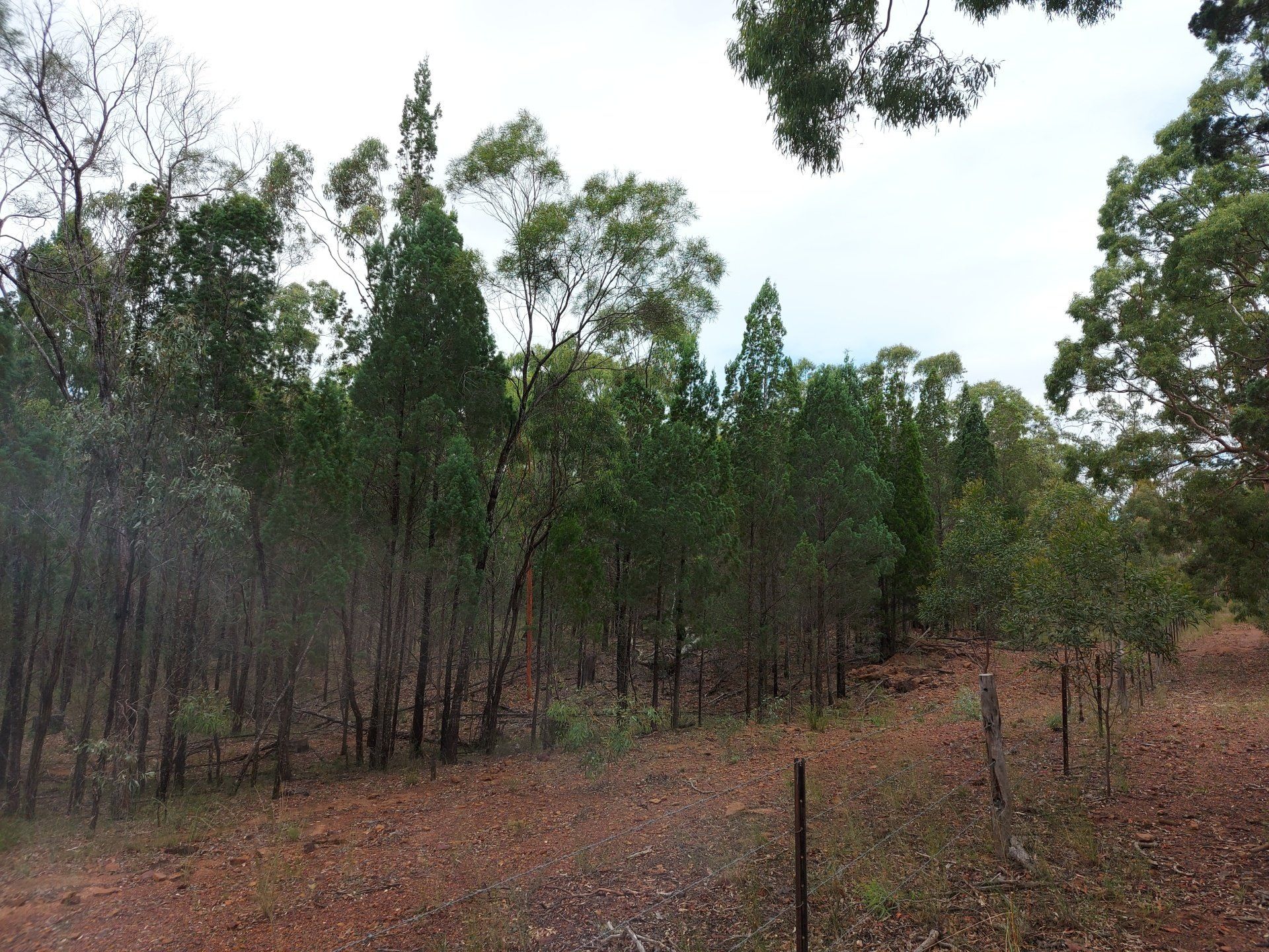
Yes, development is permitted in bushfire prone areas if the risk to people and infrastructure is manageable and does not unnecessarily and unreasonably place people, infrastructure and the environment at risk It is common for development applications to be lodged to Council and for Council for request a bushfire hazard assessment (BHA) or bushfire management plan (BMP) where a site falls within a mapped bushfire prone area. This provides certainty to Council that potential risks which may occur at a site are able to and will be managed. Assessments can be basic or complex, depending on your proximity to bushland, surrounding slopes and location. We can assist you determine a suitable bushfire management strategy which incorporates the following (if necessary): Fire management lines or fire trails Firebreaks or asset protection zones Firefighting capabilities Built development requirements, consistent with Australian Standard (AS) 3959:2018 (Construction of buildings in bushfire-prone areas) Bushfire Attack Levels (BALs) may also be determined and applied to your development to ensure that appropriate building design and construction occurs in accordance with the Australian Standard. Compliance with the standard is very manageable and unlikely to drastically increase your project costs where early planning and identification of building requirements is undertaken. Additionally, at the project planning phase (i.e. subdivision), building location envelopes (BLEs) may also be prescribed to provide a suitable location for future development. Range Environmental can assist with your bushfire assessment and reporting needs and is experienced in assessments against both Council Planning Schemes and the State Planning Policy (SPP) provisions, including: Initial project feasibility constraints analysis Bushfire hazard assessment Bushfire management reports Post development approval advice
Yes, depending on what you plan to build and use the land for. Development for purposes such as housing, industry, infrastructure and essential services may be permissible when assessed against the Regulations. Requirements for meeting State Government regulations apply and you may not be able to clear all trees, unless absolutely necessary to achieve your development outcome. A number of exemptions also apply under the Planning Regulation 2017 which allow you to clear koala habitat for several reasons, including: Clearing for a fence road or track (width restrictions apply) Essential management of the land for necessary fire management or safety purposes (restrictions apply) The construction of non-linear infrastructure (i.e. a house or shed) which requires up to 500m 2 of clearing) Range environmental is experienced in managing projects which exceed the exempt clearing allowances and trigger State Code 25: Development in South East Queensland koala habitat areas. We have successfully assisted town planners, developers and homeowners to navigate State Government assessment requirements, with an aim to provide a solution which is both good for the client, and the environment. Requirements of the State also apply in addition to Local Government requirements. Range Environmental can assist with all your ecology, bushfire and environmental planning project needs. A number of services can be provided to assist you, including: Preliminary desktop ecological constraints analysis Detailed ecological constraints analysis and advice (including vegetation surveys) Koala Habitat Assessments and Ecological Assessment Reports (which may be required for developments which impact koala habitat) Koala management plans Rehabilitation and covenant management plans Vegetation, habitat tree and compensatory habitat management plans Our staff have expertise in both desktop and field assessments and can provide specialist services including attendance at pre-lodgement meetings with the State Government (SARA) and Council, vegetation and tree surveys (utilising high precision GPS systems), State and Local code responses, significant residual impact assessments and negotiation of decision notices. Our koala assessment projects across western, southern, and northern SEQ include a range of development types, including: Small, medium and large residential subdivisions Retail and service developments Infrastructure development Rural and multi dwelling projects Infrastructure projects
The Queensland Government is developing a new waste management and resource recovery strategy, which includes a waste levy, commencing 1 July 2019. The levy rates will apply to landfill operators (local councils and private businesses), who will pay the levy to the Queensland Government based on the amount of waste disposed of to landfill. Each landfill operator will determine how the levy is passed down to customers, for example, through increased gate fees. Levy zones have also been established based on where the majority of waste is generated and disposed. Levy zones mainly apply to larger local Council areas in eastern Queensland. Waste transporters must give the operator of a waste disposal site information regarding the type of waste, whether it is exempt and whether the waste was generated inside or outside the levy zone. Some types of soil contaminated with a hazardous contaminant from land listed on the Environmental Management Register (EMR) or Contaminated Land Register (CLR) can apply for exemptions . Other community members who are exempt include - waste received as part of charity donations that cannot practicably be re-used, recycled or sold; and litter and illegally dumped waste which is collected as part of a community activity. Further information can be found on the Queensland Government website .
You property could have ecological protections over it under Local, State or Federal legislation. It is also important to realise that even if your property doesn’t have any trees, it may still be subject to some form of ecological protections under different laws. Local To check what controls or protections may apply to your property at the level of Local Government you should refer to your Council’s planning scheme which will usually include overlay maps that show the locations of protected vegetation, wateways, wetlands or habitat. You should also check if Council have any local laws which might apply to clearing or earthworks. State State legislation that protects ecological values includes Vegetation Management Act 1999, Planning Act 2016, Environmental Protection Act 1994, Nature Conservation Act 1992 and Water Act 2000. You can access this legislation from the Queensland Parliamentary Counsel . There are several online mapping resources that you can search to understand some of the controls or restrictions may apply to your property to protect vegetation, threatened plants or animals, essential habitat, wetlands and waterways. Some links to these resources are below: Regulated Vegetation High Value Regrowth Vegetation Koala Habitat Maps Protected Plant High Risk Areas Matters of State Environmental Significance Environmentally Sensitive Area Maps Wildlife Online Database Referrable Wetlands State Planning Policy (SPP) State Development Assessment Provisions (SDAP) Fish Passage Waterways Many of these mapping layers and more are also available through Queensland Globe . Some searches require a central coordinate or a Lot on Plan description. You can obtain these through Queensland Globe . Federal Depending on the ecological values of your property and the expected level of impact of your development or activity, you may also need to obtain approval from the Federal Government under the Environment Protection and Biodiversity Conservation Act 1999 Act (EPBC Act). A proposed activity that may have a significant impact on Matters of National Environmental Significance (MNES), such as Threatened species or Ecological Communities, should be referred to the Department of Environment and Energy to determine if it is a Controlled Action that requires approval. You can use the EPBC Act Protected Matters Search Tool to check if there may be ecological values at your property that are MNES.
This is a common question that we are asked and unfortunately there isn't a simple answer. This is because it varies by the zoning of land, purpose and extent of the clearing, the sensitivity of the area to be cleared and if your property is subject to any protections under Local, State or Federal legislation. In general terms, clearing may be: Exempt - no approvals are required; Self-assessable - must be undertaken in accordance with an Accepted Development Code or similar. Sometimes notification may need to be provided before and after the works; or Assessable development - you will require a Development Approval to undertake clearing. Prior to any tree clearing we recommend completing at least a desktop assessment of your property to helpy identify protections that may be in place over your property under Local, State or Federal legislation. The desktop assessment may need to followed up with a field assessment by an ecologist to verify the ecological values at your property and confirm the approvals or permits that you require. It also important to understand that clearing of trees may have other impacts which need to be considered as this could require different kinds of approvals or permits. This could involve damage to habitat for protected animal species, impacts to protected grasslands, wetlands or waterways.
Yes, you can remove soil from land that is listed on the EMR but laws are in place to manage this process. Contaminated soil can only be removed from land on the EMR under a Soil Disposal Permit that is issued by the Department of Environment and Science. Contaminated soil can be moved to a landfill, waste treatment facility or to other land on the EMR. To apply for a Soil Disposal Permit, the soil needs to be adequately investigated by a Suitably Qualified Person (SQP) in accordance with the National Environment Protection (Assessment of Site Contamination) Measure 2013 (NEPM) . A Soil Disposal Permit application takes 10 business days to be processed by the Department of Environment and Science. To avoid delays during the construction phase of a project it is recommended that early consideration is given to obtaining Soil Disposal Permits. Uncontaminated soil can be removed from land listed on the EMR without the need for a Soil Disposal Permit. This should be undertaken in accordance with the General Environmental Duty (GED) under the Environmental Protection Act 1994 .
In Queensland, contaminated land investigations are required by law to be undertaken by a Suitably Qualified Person (SQP) in accordance with the National Environment Protection (Assessment of Site Contamination) Measure 2013 (NEPM) . There are four main stages to a contaminated land investigation. It is important to note that in some cases not all stages are required, alternatively some stages may need to be repeated for some sites: Preliminary Site Investigation - to understand the site history and areas of concern. Detailed Site Investigation - testing to understand likely contamination at the site. Health and Environmental Risk Assessment and Development of a Remedial Action Plan (RAP) - to address contamination that may be present. Implementation of RAP and preparation of Validation Report - to clean up the contamination and verify the works were successful. The investigation works are dependant on the outcome required. You may require a site investigation for a Statutory Outcome. A Statutory Outcome includes removing land from the EMR, issuing a Site Suitability Statement to confirm land is suitable for a proposed use or a Site Management Plan (SMP). If a Statutory Outcome is required, the site investigation will need to be undertaken by a Suitably Qualified Person (SQP) in consultation with a Contaminated Land Auditor (CLA) . The SQP undertakes the investigation and reporting works and the CLA certifies all the works and reporting completed by the SQP. A CLA is similar to a Building Certifier.
Yes, you can apply to the Department of Environment and Science (DES) to have land removed from the EMR. For land to be removed from the EMR it needs to be suitable for the most sensitive land use (e.g. a residential dwelling or childcare centre). This applies even to commercial or industrial land that is unlikely to ever be used for a sensitive land use. A policy has been developed that outlines the criteria to be met to remove land from the EMR . To remove land from the EMR, you require a Suitably Qualified Person (SQP) and a Contaminated Land Auditor (CLA) . The SQP undertakes the investigation and reporting works and the CLA certifies all the works and reporting completed by the SQP. A CLA is similar to a Building Certifier. The typical process for removing land from the EMR is below. Be aware that contaminated sites vary widely as does the work which is required to make them suitable for removal from the EMR: A site investigation by the SQP to determine the site history and condition. If contamination is present, clean-up or remedial works may be necessary. After these works, validation testing is undertaken by the SQP to confirm if the clean-up was successful. Preparation of a Contaminated Land Investigation Document (CLID) by the SQP. Certification of the works and CLID prepared by the SQP by the CLA. Submission of an application to DES to have the land removed from the EMR.
Yes, you can develop land that is on the EMR even if it is contaminated. There are planning laws in Queensland to ensure that developments on contaminated land are safe. These laws apply to both sensitive land uses and non-sensitive land uses. A sensitive land use is usually any kind of accomodation, residential, childcare, educational or health care land use. Other uses, such as commercial and industrial developments are non-sensitive land uses. If you are proposing to change the use of land on the EMR to a sensitive use, or you are proposing a commercial development with a basement carpark or other underground space then your development may be assessable under the Planning Regulation 2017 . If the development is assessable it is likely that you will require a site investigation to understand the condition of the land. The site investigation will need to be undertaken by a Suitably Qualified Person (SQP) in consultation with a Contaminated Land Auditor (CLA) . The site investigation may recommend some clean up or remediation is required to make the site suitable. It may also determine that the site is suitable for removal from the EMR, suitable for certain uses without further controls or suitable for certain uses if a Site Management Plan (SMP) is implemented. There are a range of considerations when developing land on the EMR that will be influenced by time, budget, land use, land value and site conditions. We recommend that contaminated land is considered early in the project planning phase to ensure your development proceeds efficiently.